1. What is Contour Interval?
A contour interval is an elevation difference between two contour lines in a topographical map.
” If THE area to be mapped is larger, THE contour interval will be larger & vice versa”
✓ The contour interval is described in every map on the right-bottom side.
✓ The commonly utilized contour intervals are 20 feet or 40 feet o,r 80 feet for a 1:24,000 map scale.
✓ To calculate the contour interval, we need to divide the difference in elevation between the index contour lines by the number of contour lines from one index contour line to the next.
2. Steps of Calculating Contour Intervals
Step 1:
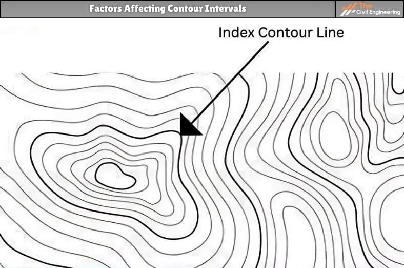
✓ Locate two index contour lines ( Bold Lines ) that are given with a specific elevation.

Step 2:
✓ Now, find the elevation difference between two selected index contour lines.
Elevation Difference= Higher elevation – Lower Elevation
Step 3:
✓ Calculate the number of non-index contour lines between two selected index contour lines.
E.g., If there are 4 non-bold lines between two bold lines, the number of non-index contour lines is 4.
Step 4:
✓ The number of lines calculated in the above step is noted and added with 1.
✓ Let’s take a simple example: If the number of non-index contour lines is 4, add 1, making 5.
Step 5:
✓ Find the quotient of the elevation difference between two contour index lines (step 2) and the number of non-index contour lines by adding 1 (step 4).
Contour Interval = (Elevation Difference) / (Number of non-index contour lines + 1)
3. Example Calculation of Contour Interval

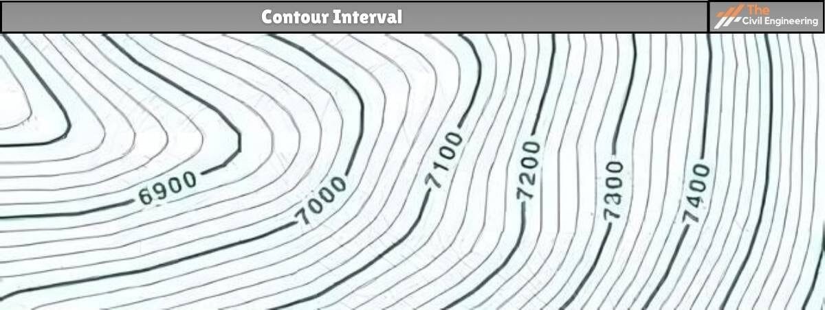
Taking the given maps, the steps needed in contour interval calculation are,
Let us take 7100 and 7200 and find the interval between them.
✓ The elevation difference between 7200 and 7100 = 7200 – 7100 = 100
✓ The number of contour lines in-between 7200 and 7100 = 4
Adding 1 we get 4 + 1 = 5
✓ Now, we need to divide 100 by 5, 100/5 = 20 units
The Contour Interval of the given map is 20 Units.
4. Few Things You Should Know
a. Every point of a contour line has a similar elevation.
b. Contour lines distinct uphill from downhill.
c. Contour lines never touch or cross each other than at a cliff.
d. Every 5th contour line is darker than other contour lines. This is an INDEX contour line.
e. Contour lines are nearer together in steep terrain and farther apart in flat areas.
5. Factors Affecting Contour Intervals
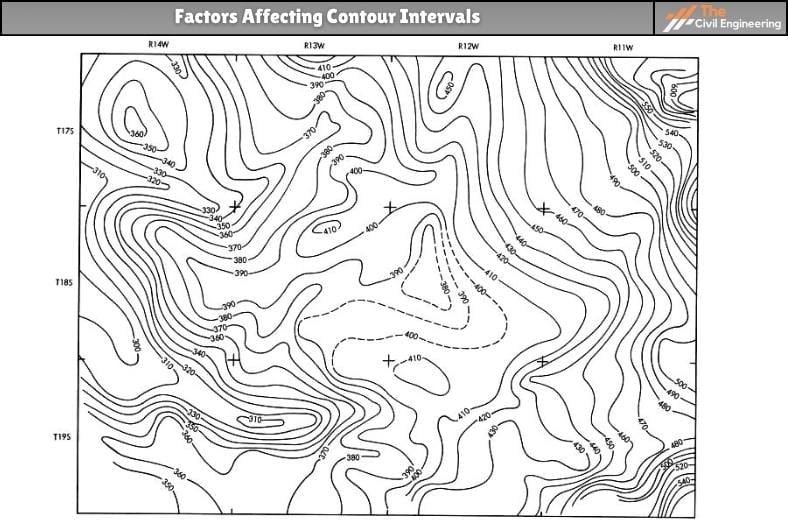
Factors affecting contour interval are:
a. Scale.
✓ Larger the scale, the contour interval will be smaller, and vice versa.
b. Importance and purpose for which the plan is to be used.
✓ For more details, a small contour interval is used.
c. Accuracy, time, and cost of the contour plan.
✓ For higher accuracy, a smaller interval is used.
d. Topographic variation of the area
✓ A large contour interval is utilized for flat ground, while a small one is utilized for steep ground.
e. Size of the area
✓ For larger areas, a larger contour interval is utilized.
6. Advantages of Contour Interval
a. It shows the slope and size of different landforms on the map. This helps to visualize elevation changes.
b. By looking at the contour intervals, it is easy to calculate the various elevations of the landscape.
c. It can be utilized in drawing cross-sections of the specific features on the mapped area.
| Read More: Levelling in Surveying |
7. Disadvantages of Contour Interval
a. Contour may fail to represent a few elevations due to the limitation of the contour interval.
b. Some landforms cannot be represented by contours—for example, coral reefs, outcrop rocks, and craters.
c. The contour method is not utilized to represent relief on a small-scale map as it may omit finer details.
8. FAQs
| 1. What is the contour interval of the map? A contour interval is an elevation difference between two contour lines in a topographical map.
2. What Color Is an Index Contour Line? Index contour Lines are darker and broader, primarily black or brown.
3. Why Are Contour Lines Useful? Contour lines are beneficial because they permit us to depict the shape of the land surface (topography) on a map. |
Read More: Contouring
Read More: Soil liquefaction


